
Miramichi Watershed
|
Areas Page Editors: please follow the Guidelines, whether you are editing an in-game area or World Territory. |
On this page... (hide)
- 1. Description
- 2. Landmarks
- 2.1 The Swamp
- 3. Waterways
- 3.1 Miramichi River
- 3.2 Bartibog River
- 4. Sources
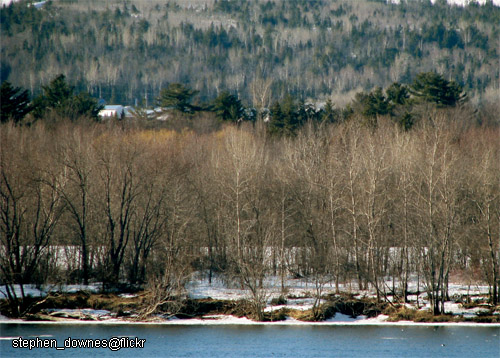 | |
| Credit | stephen_downes@Flickr |
|
General | |
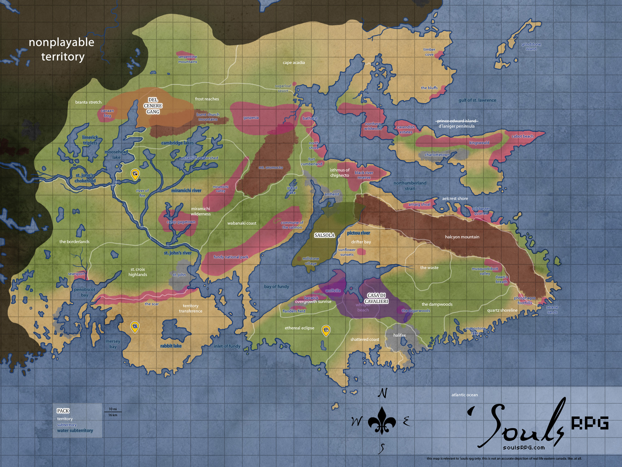
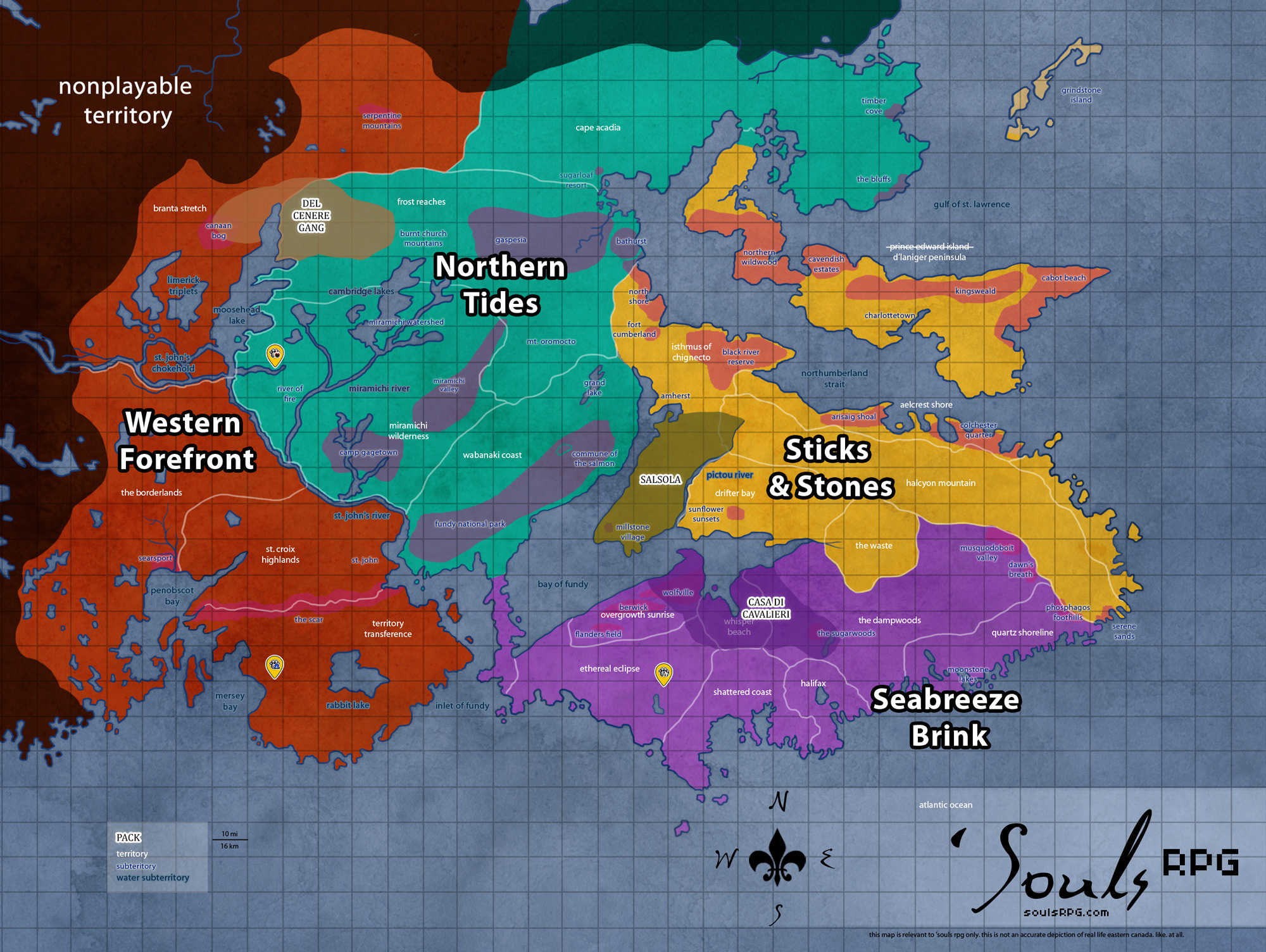
| Region | Northern Tides |
| Territory | Miramichi Wilderness |
| Major Waterways | — |
| Size | ?? sq km / ?? sq mi |
|
Roleplay! | |
1. Description
The Miramichi Watershed is thickly forested land, just as its counterpart to the south, the Miramichi Valley. The difference between the two areas lies in the number of rivers: while the Valley has only one artery of water, the Watershed is home to a great number of rivers. They course through the low hills and burble in the dark, damp forests. Much of the rich soil here is damp and moist in summer, almost swamp-like. In winter, though, the whole of it freezes rock solid.
2. Landmarks
2.1 The Swamp
Nestled on the outskirts of what was once Krokar lays a murky swamp, with water the color of tar. The area is said to be cursed by the River Goddess, as numerous canines have gone in, but none have come out. The area can be found just north of where the River of Fire and the Miramichi River meet, where the natural watershed has grown murky and thick with decaying vegetation. The area is normally shrouded in a nauseous fog and is usually avoided by anyone who doesn't want to spend hours getting muck out of their fur.
Because of its secluded and uninhabited location, The Swamp has become the perfect spot for a mysterious healer to call home.
3. Waterways
3.1 Miramichi River
The Miramichi River refers to a collection of rivers: there are Little and Big Miramichi Rivers, as well as the Northwest Miramichi and Southeast Miramichi. Many tributaries are in the Miramichi Watershed areas, but several streams and one Miramichi River (perhaps the Southeast or the Little Eastern -- no one is quite sure) cuts through the Miramichi Valley. The thickest part of the river takes a turn into the flatlants of the River of Fire and finally meanders south to the larger Saint John River. It is a meandering river, with very slow-moving waters. Much of its downstream waters are muddied, thickened with the silt and sediment picked up throughout its vast headwaters.
3.2 Bartibog River
The Bartibog River is a tributary of the Miramichi River, rising in the northeast of the Miramichi Watershed. It flows east and south into the Miramichi. Where the two rivers meet, a small community (also bearing the name Bartibog) nestles on the peninsula behind the rivers' meeting point. The town poorly situated -- since the time of humanity, at least half of it has sunk back into the mud. Half-drowned houses stand nearest to the meeting point of the Miramichi and the Bartibog, though the northern half of the town is still dry as of yet. Outside of this community, the Bartibog River watershed is entirely rural, dominated by forests and small farms.
- Moody's Point
The promontory on the east bank of the Bartibog River, across from the town of Bartibog proper, is called Moody's Point. It is the location of one of the oldest Roman Catholic Churches in the area, dating from the 1850s. The stone church is well-situated to avoid flooding, though its stones are damp and its air is generally humid.
4. Sources