
The Waste
|
Areas Page Editors: please follow the Guidelines, whether you are editing an in-game area or World Territory. |
On this page... (hide)
- 1. Description
- 1.1 Landmarks
- 2. Waterways
- 2.1 Minas Basin
- 2.2 Salmon River
- 2.3 Grotto dei Avernus
- 3. Islands
- 3.1 Five Islands
- 4. Likely Encounters
- 5. History
- 6. Sources
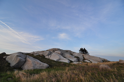 | |
| Credit | jillhudgins@Flickr |
|
General | |
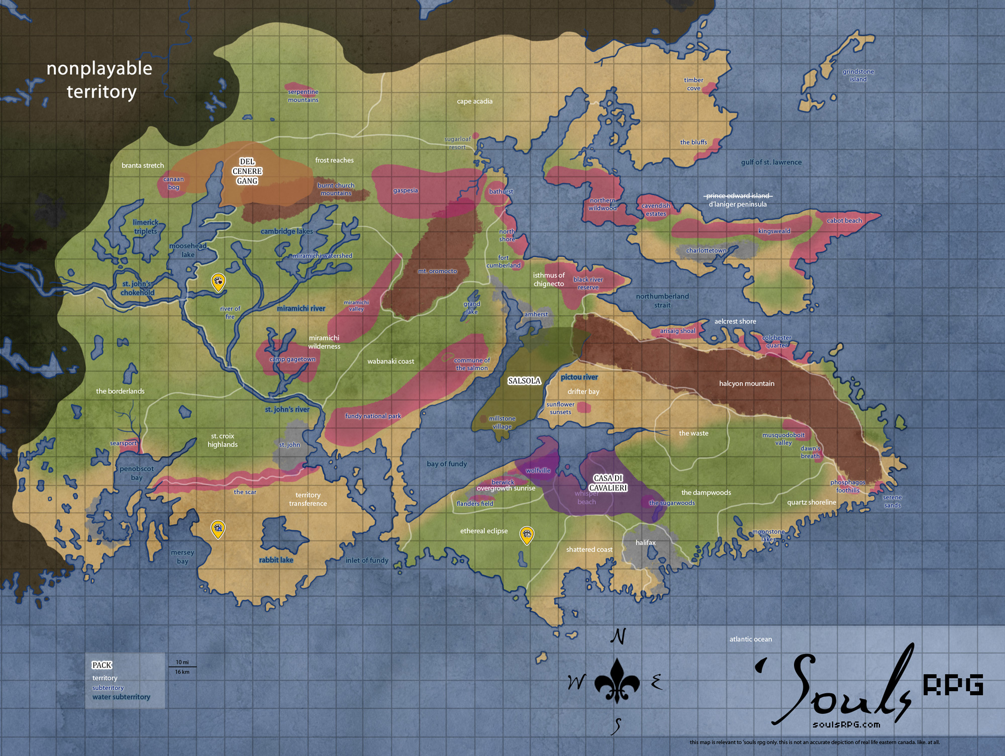
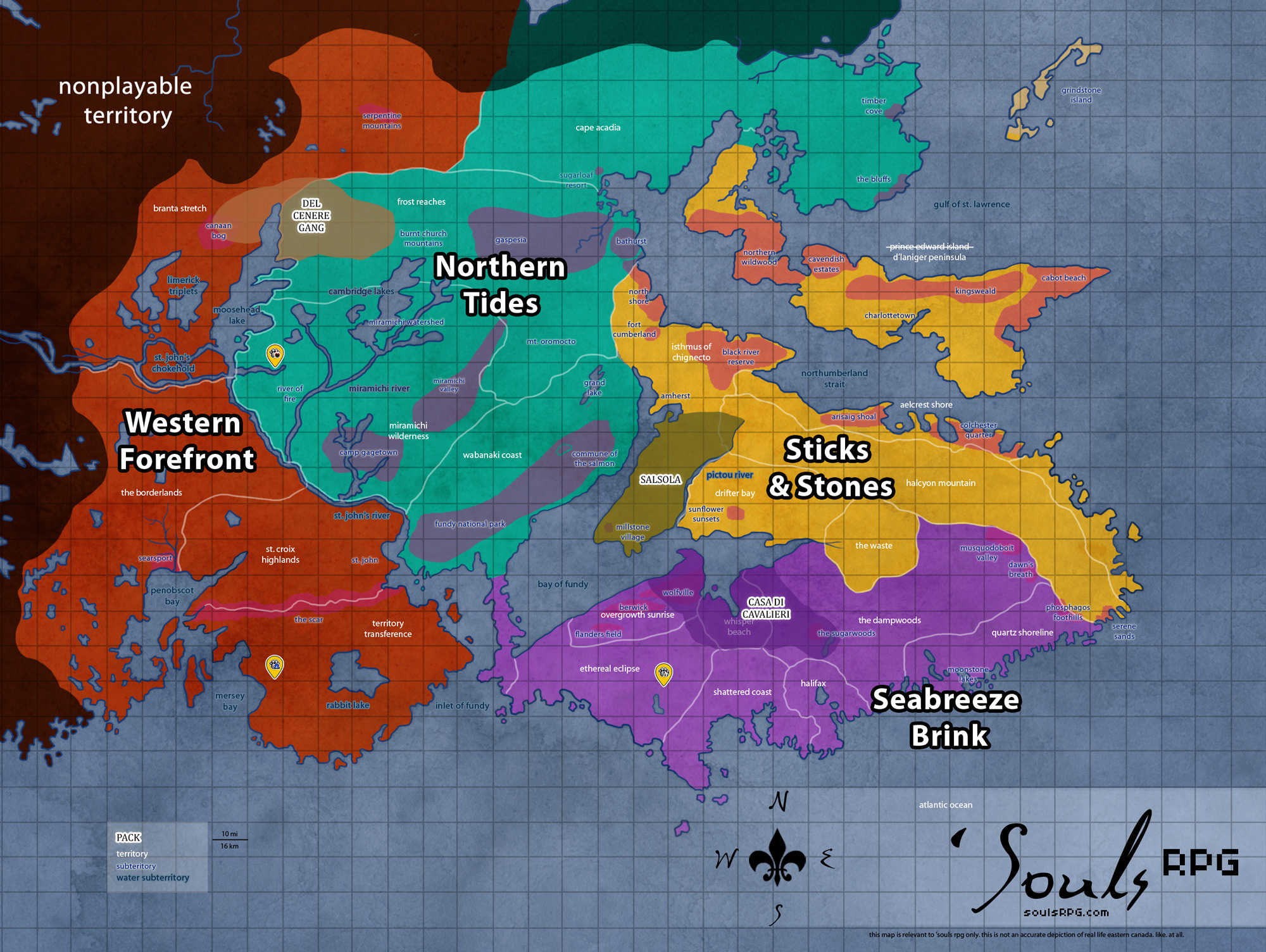
| Region | Sticks and Stones |
| Subterritories | — |
| Major Waterways | Minas Basin |
| Size | ?? sq km / ?? sq mi |
|
Roleplay! | |
1. Description
A rocky, unfriendly area with stony, jagged-rock beaches filled with dirty sand. Towards the north and east, however, the sand eases into a hillside containing several large stones and cut-rock faces, as well as a myriad of caves. As the elevation descends, the plains and tall grass give way to forest, where multiple prey animals make their homes. To the south, the sand and soil has been turned a ominous black from fire that had been set during the Second Dahlian War, resulting in the contamination of an underground river and the dangerous release of sulphur from cracks in the ground.
1.1 Landmarks
Tantramar Marshes
The Tantramar Marshes are a major region of Nova Scotia and part of New Brunswick. The marshes were primarily used for the growth of hay during the time of the humans; the flat, open land made it perfect for that purpose. Switchgrass and Bluejoint dominate plant growth, along with scraggly Jack Pine trees. This land extends over The Waste, Drifter Bay, and part of the Isthmus of Chignecto.
Grimwell Caverns
Nestled between Hades Beach and the ruins of the D'Neville Mansion, the Grimwell Caverns were once another place for Infernians to make their home. Many caves within the Grimwell system are prone to flooding.
Great Village
Just north-east of the lake and along a narrow, desolate road lays Great Village, announced by a weather-beaten sign. Perhaps once great, most of it has fallen to ruin -- the westernmost parts of the town have sunken thanks to lack of maintenance on the dykes surrounding the town. Some buildings are visible only up to their windows, their construction warped twisted to the will of the earth itself. There are few worthy of inspection for scavenged goods and fewer still worthy of occupation, but prey animals take up residence in the shattered remnants of buildings.
Devil's Demesne
A two-lane highway winds through the dry, rolling hills of this area. Overgrown and cracked, most of the road has broken into smaller islands of asphalt. The remains of two tiny gas stations, Rockbuster's Last Gas to the north, and Jacko's Pop and Gas to the south, can be found along the highway if one knows where to look. These days, very little remains beyond the rubble -- and the grassland has already begun to reclaim this.
Burned Plains
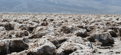
The southernmost tip of the Waste is blackened and burned, the soil turned to ash and the even the hardy vegetation that grows rampantly over the rest of the waste refuses to take root here. The earth is scarred a deep black here, results of the Second Dahlia War. The underground river that was once a part of Inferni's territory has been contaminated with toxic ash runoff from the fire; now the rotten egg smell of sulphur smell rises up from the crack in the open ground, noxious and deadly if breathed in for too long.
2. Waterways
2.1 Minas Basin
The Minas Basin is the easternmost area of the Bay of Fundy. Drifter Bay sits to the north, with The Dampwoods and Whisper Beach to the south. The Minas Basin is defined by the huge headland area in Whisper Beach, known as Cape Split; a narrow channel, known as the Minas Channel, separates the Minas Basin from the rest of the Bay of Fundy.
Sediments in the basin, which are brought in and deposited by tides, range from coarse sand to fine silt and clay -- and contribute to the thick, brown color of the waters. No other coastal marine area has such a large proportion of its floor exposed at low tide. This results in large mudflats at low tide, consisting of thick, sinking bay mud (thick deposits of soft, unconsolidated silty clay, which is saturated with water -- often running) that can easily trap a canine, horse, or other heavy creature.
- Minas Channel
Though one can view the opposite shore from Cape Split on a clear day, the extreme volume of water flowing through the narrow point of the deep, 5-kilometre (3.1 mi) -wide channel Minas Channel makes for incredibly dangerous tides. At mid-tide, the currents exceed 8 knots (4-metre (13 ft) per second). The flow on the north side of Cape Split equals the combined flow of all the rivers and streams on Earth together (about 4-cubic-kilometre (0.96 cu mi) per hour.). - Southern Bight
The southerly area of the Minas Basin, the Southern Bight, has Overgrowth Sunrise to the west and Whisper Beach to the east. The Southern Bight is 59% estuary mudflats, 34% marine flatlands, 7% salt marsh, and less than 1% sandy beach. - Cobequid Bay
The small, narrow piece of the larger Minas Basin that extends into The Waste. The Cobequid Bay, similar to the Shepody Bay in the Chignecto Bay, receives the brunt of the Bay of Fundy's tides. The coastlines are sharp, stark headlands that rise over mudflats -- or just barely contain the baywaters, depending on the tide.
2.2 Salmon River
The meandering Salmon River runs through The Dampwoods and parts of The Waste. The river itself is wide and rather shallow in most places, with a lazy and slow current throughout its journey through Drifter Bay. It has rather wide and fertile delta, though of course nothing was built upon it in the humans' time for the extreme tides found in the Bay of Fundy. This is evidenced every day by the tidal bore that travels up the Salmon River, literally reversing the flow of the river closest to the ocean.
2.3 Grotto dei Avernus
The especially rainy second half of of 2009 caused extensive flooding to parts of The Waste. When the floodwaters receded, they caused some erosive damage to the land, revealing hot springs. The area is always muggy and far warmer than the surrounding areas, heated by the earth itself, and a thick fog clings around the springs themselves during the winter, and the area is remarkably humid during the summer. The waters temperature hangs at around 75°F/24°C, though it varies depending on how much rainwater pools in. This is one of only a few hotspring areas in Nova Scotia.
3. Islands
3.1 Five Islands
These five tiny islands sit just off the coast of The Waste on the Bay of Fundy. All of the islands support a number of Seal species.
- Moose
Early in the 1800s a man settled here with his family. He cleared the forest and established a modest mixed farm. Rumors circulated about his abusive tendencies; he died under violent, suspicious circumstances and the remainder of his family moved to mainland Canada, abandoning the island. Legends continued to circulate about the island in the times of humanity; it's said sometimes a light can be seen on the beach of Moose island. - Long
The sea, being in the Bay of Fundy's tide reach, is 30 to 50 feet (9 to 20 m) deep at high tide and empty at low tide, so access to the island is limited each day to a four hour window, namely the high tide during daylight. When the tide is low, those on Long Island can walk or run on the sea bed for miles. The largest island, Long has a tiny "town" of three dilapidated shacks. - Diamond, Egg, Pinnacle
These smaller islands were not inhabited. The larger of the pair -- Diamond and Egg -- sparse, piney forest and birds. Pinnacle, on the other hand, is little more than a bare rock jutting from the bay.
4. Likely Encounters
- Bay Horses: The Smoke Herd has taken up residence in the Waste after moving eastward.
- The Troupe has taken up residence in The Great Village, and its members can often be found in the area.
5. History
- In early 2010, during the Second Dahlian War, the lower part of The Waste, then claimed by Inferni, was burned by Haku Soul and Sicarus de Ericeto. This action caused Inferni to shift its territory northward, claiming a piece of Halcyon Mountain to make up for the burned area.
- In November 2017, following the devastation of the Inferni-Salsola War, the coyotes of Inferni moved their territory to the Eastern Realms and left The Waste unclaimed.
6. Sources