
North Shore
|
Areas Page Editors: please follow the Guidelines, whether you are editing an in-game area or World Territory. |
On this page... (hide)
- 1. Description
- 2. Landmarks
- 2.1 Cedarsands Chalet
- 2.2 Starfall
- 3. Waterways
- 3.1 Fireship Channel
- 4. Islands
- 4.1 Mictou Island
- 5. History
- 6. Sources
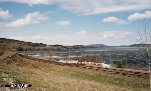 | |
| Credit | hockadilly@Flickr |
|
General | |
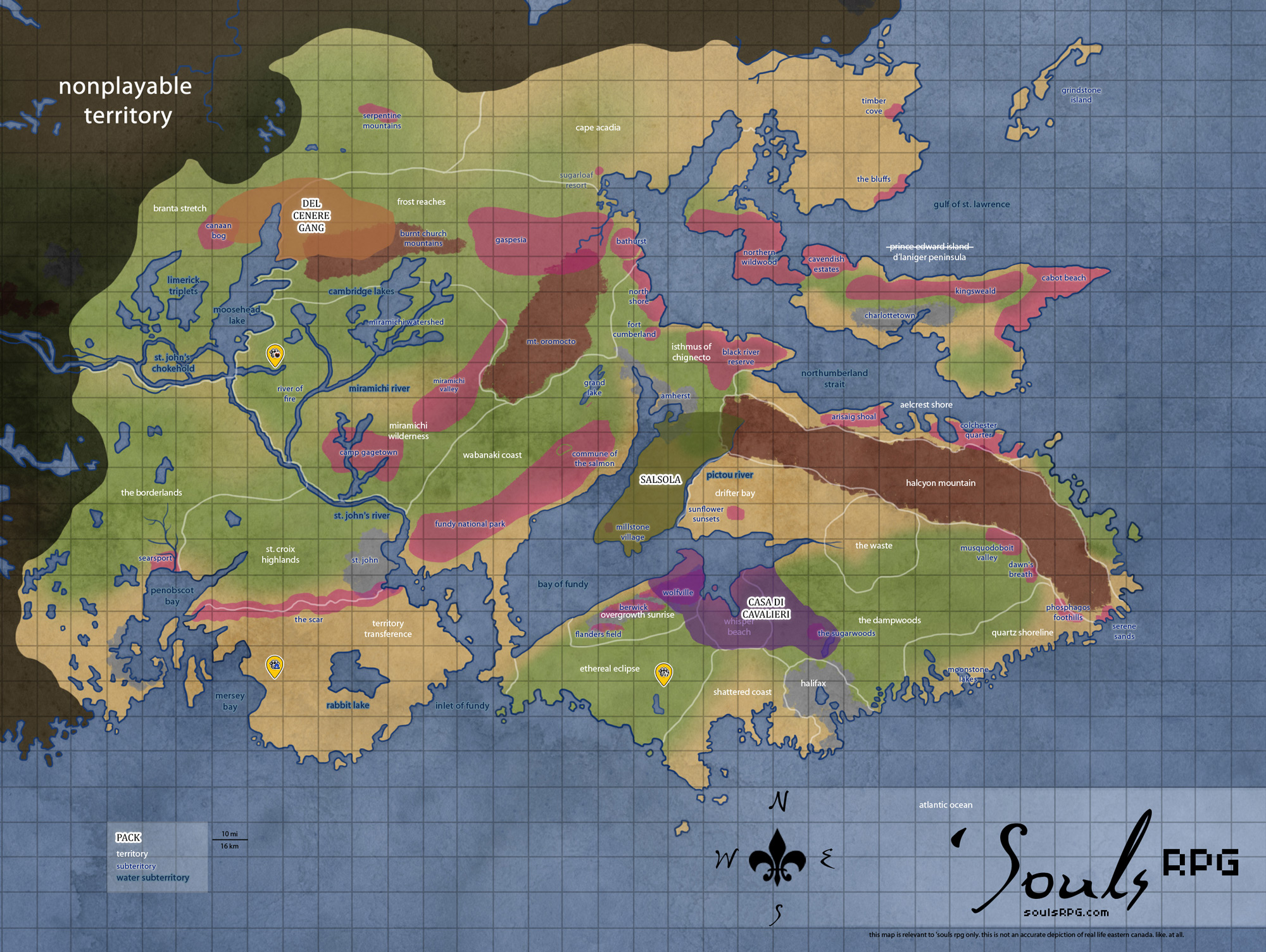
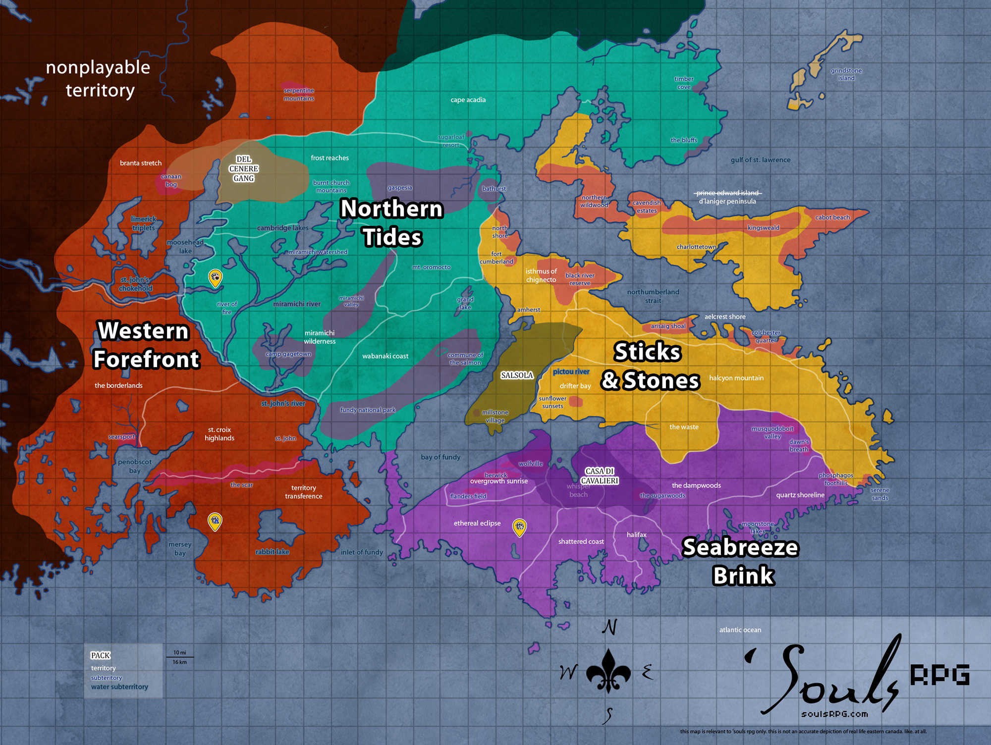
| Territory | Isthmus of Chignecto |
| Major Waterways | Northumberland Strait |
| Size | ?? sq km / ?? sq mi |
|
Roleplay! | |
1. Description
The North Shore, unlike the Fundy coasts to the far south, is not a coast of incredible tides. On the contrary, most of the currents along the shore are relatively weak, and the tidal range is typical for Atlantic coasts. Most interesting are the numerous barachois formed along the shore -- areas where sand bars have formed, creating salt water lagoons along the shore. The cutting wind has an icy edge as it sweeps down from the far north, and is perhaps the largest danger to those who might seek to land or launch a boat here. Many of the former human communities, although falling to ruin, were fishing communities, sustained by the rich Atlantic Salmon entering the rivers and estuaries of the terrain.
2. Landmarks
2.1 Cedarsands Chalet
Right at the edge of the forest, looking out over the reeds and sand with a view of the ocean, this overgrown single-story chalet was once a seasonal rental. It is a low, wide building whose paint has largely peeled off in some areas. Nature has nearly reclaimed it now, along with much of the road that leads to it. There are vines growing up the most of the structure, and, in the back, they grow into a hole in the wall and out through the ceiling of what used to be a bedroom. Most of the windows are broken out completely, but the walls are still sturdy enough. The surrounding property is dotted with storage sheds, what used to be a treehouse, and a broken fence line. (Created by Myst for a Sapient Territory Contest)
2.2 Starfall
A cliff residing at the hooked land along the North Shore. Its name comes from its clear view of the ocean and the stars that reflect off the surface at night. It is a good place to watch them, especially if someone is lucky enough to watch the stars fall. (Created by Salena for a Sapient Territory Contest)
3. Waterways
3.1 Fireship Channel
Fireship Channel is the northernmost arm of the Northumberland Strait around the areas of Bathurst and the North Shore. This area of the Strait is generally unremarkable from the rest with the exception of the phenomenon that occurs on its water. The Fireship, more commonly referred to as the Chaleur Phantom, is a ghost light (an unusual visual phenomenon) occasionally seen on the bay. The Fireship takes the form of an arc of light, usually seen before a storm. Its cause is unknown, but speculation includes rotting vegetation, undersea releases of natural gas, and St. Elmo's Fire. The phenomenon is a source of numerous rumors and tales; it has been said to appear as a flaming three-mast galley, hence its name. One version of the ship's origin tells of a group of pirates who aggressively attacked what appeared a wealthy woman, only to have killed a witchdoctor in disguise. With her dying words she cast a curse upon them: "For as long as the world is, may you burn on the bay." This legend may be reason for the many rumors that ghosts have been seen wandering the docks, including men aflame, but such things certainly cannot be confirmed.
- The Fireship Channel is home to many ghost stories and sightings.
4. Islands
4.1 Mictou Island
Even larger is lush Miscou Island, located just above the peninsula extending above Fort Cumberland. Miscou island is quite large, having supported a community of about 650 humans before the apocalypse. The French-speaking community was accessible only by cable ferry (which no longer exists). There are barrier islands extending to the southeastern corner, but there are breaks between the islands and one needs to swim in order to access the thickly-forested island.
The major industry was fishing, primarily lobster and herring. Peat moss on the island has not been harvested and is left in its natural state. The island's sand dunes and lagoons host a variety of migratory birds, and its gentle shorelines invite mainland Luperci into the cold waters of the Northumberland Strait.
5. History
- Sapient previously claimed the North Shore since October 2014 to July 2018.
6. Sources