
Areas
|
Areas Page Editors: please follow the Guidelines, whether you are editing an in-game area or World Territory. |
Introduction
|
On this page... (hide)
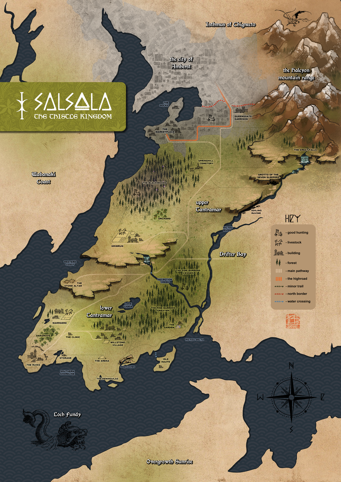
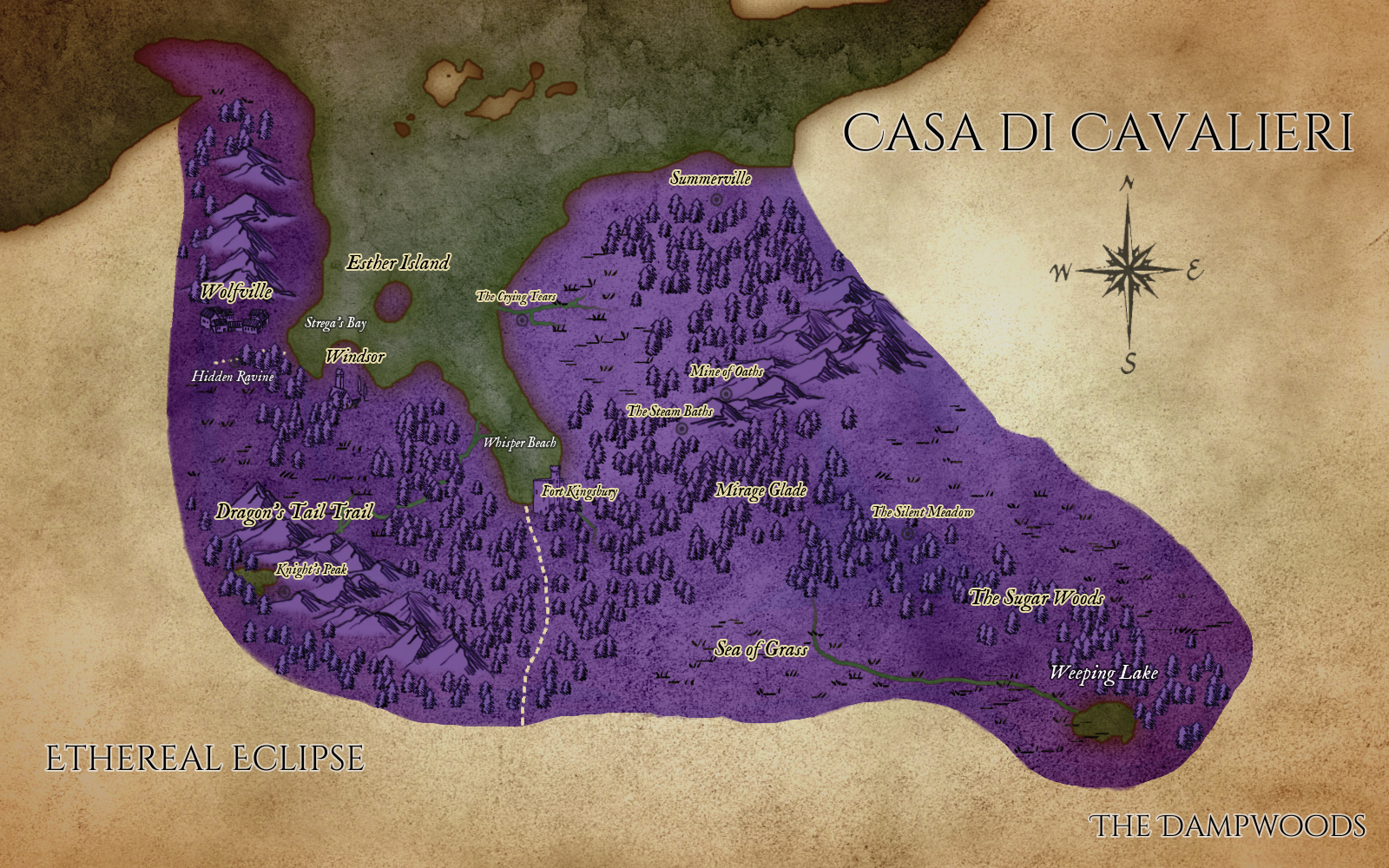
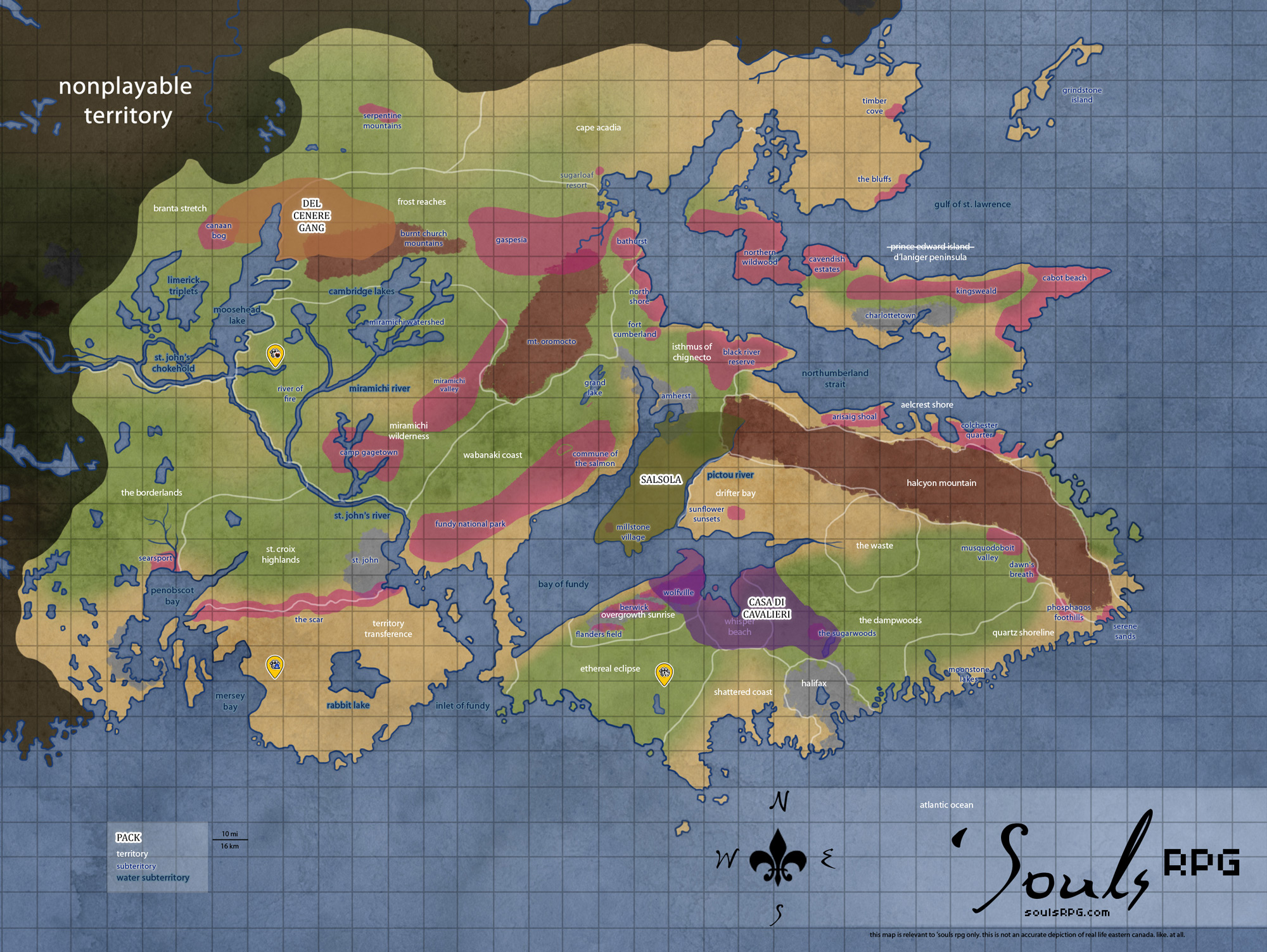
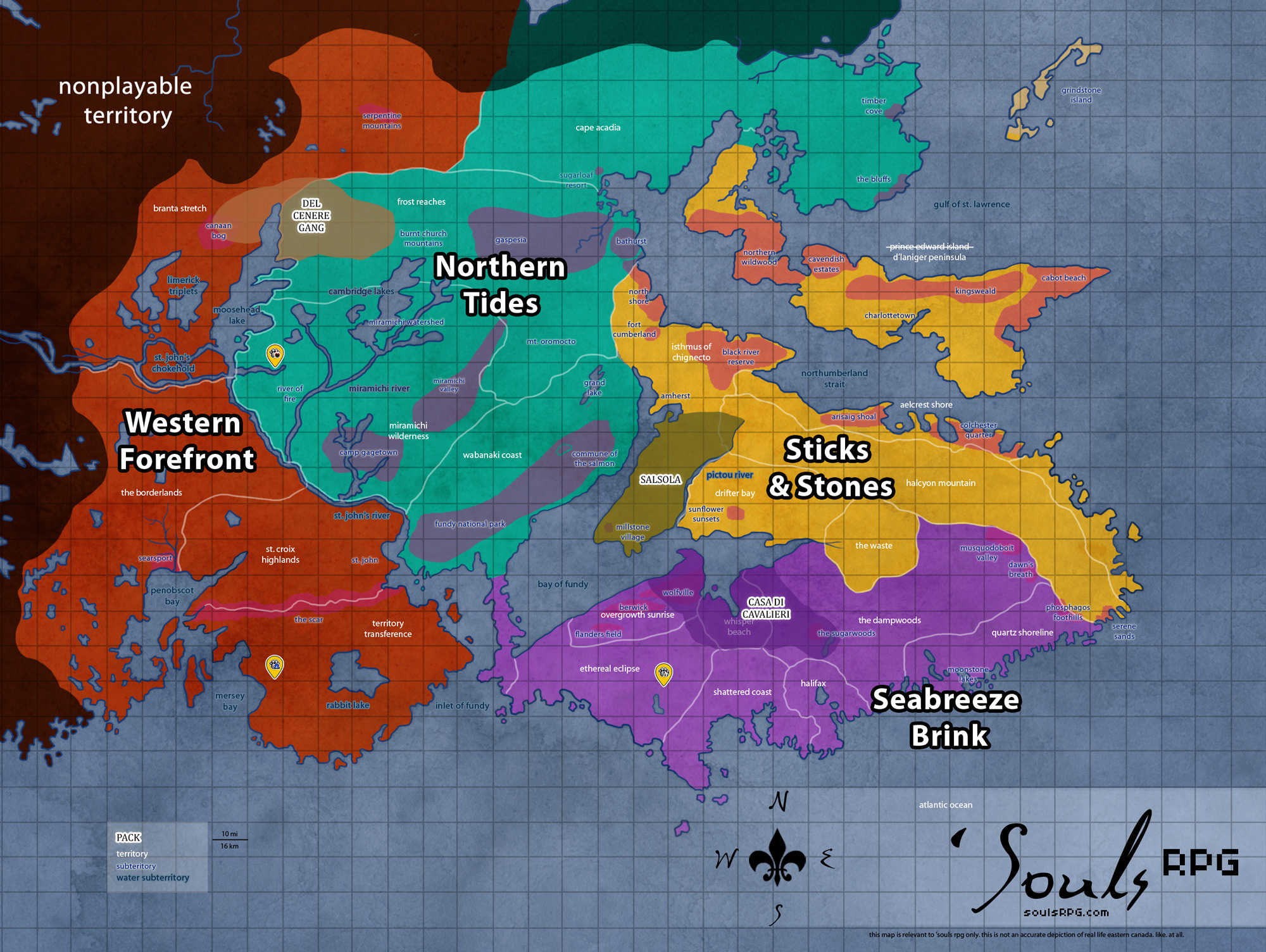
'Souls takes place across the eastern Canadian Maritime Provinces of Nova Scotia, Prince Edward Island, and New Brunswick. However, the 'Souls fictional version of Eastern Canada bears some stark differences from reality. For example, Cape Breton is an island in real life; in 'Souls, it is a peninsula. New Brunswick also has a lot more landmass at 'Souls than in reality! So reference our map instead of a real one. ;) For more information about the area, please visit the Detailed Overview wiki page and the Area and Setting Information forum topic. |

1. Editing Guidelines
- Members are not permitted to add new territories of their own creation to the 'Souls playable game area. Clean-up of the landmarks and flora/fauna sections can be done, but the description of the 'Souls territories themselves should be left alone unless you're fixing discrepancies between the Wiki and the official territory descriptions in the forums (assume the forum is the updated version).
- Landmarks can be added, but use your better judgement, please. A huge city is not an acceptable landmark. A small storefront is.
- Likely encounters mark different NPCs (e.g. bNPCs or various player NPCs) that may be encountered in a given territory, as well as active characters that may reside in or frequent an area. Inactive characters and "floating" NPCs should be removed from the page or moved to a 'Former Residents' list to avoid confusion, as these characters cannot be referenced as still being in the area.
- Flora and Fauna can be edited, but make sure you adhere to the Flora guide on the Wiki.
2. Resources
2.1 Detailed OverviewThe Areas Detailed page can give you a broader overview of 'Souls playable areas -- the land's geography and history, as well as climate and weather information can be found here. |
2.2 MapsWe have a large collection of Maps available for players -- everything from canine subspecies maps to pack maps are listed on this comprehensive page. |
2.3 Flora & FaunaFind information about the plants and animals found within the 'Souls playable area here. Some exotic and non-native species traded into the game are even covered here. |
2.4 Geological FeaturesIf you're interested in learning more about the different geological features found here, see our lists of the landforms, islands, and waterways! |
3. 'Souls Territories
3.1 Current Playable Areas
3.2 Active Packs
Non-Packs |
4. Defunct Areas
4.1 Former 'Souls Territory
4.2 Bleeding Souls
These territories were the former locations of Bleeding Souls, destroyed in the 2008 fire. Starting in summer of 2011, the old territories began to be reopened, albeit vastly changed. The territories listed herein no longer exist in this form, though they may be reincorporated in part or in whole in the Withered Realms territories.
5. Beyond 'Souls: World Territories
These non-playable locations outside of the active game territory are useful for creating new characters or noting information. Again, please note: the World Territories are all outside of 'Souls playable, in-game area. They do not show up in-game except perhaps in LASKY.