
Aelcrest Shore
|
Areas Page Editors: please follow the Guidelines, whether you are editing an in-game area or World Territory. |
On this page... (hide)
- 1. Description
- 2. Subterritories
- 2.1 Arisaig Shoal
- 2.2 Colchester Quarter
- 3. Waterways
- 4. Islands
- 4.1 Heron Island
- 5. History
- 5.1 Claimed Land
 | |
| Credit | urbanmkr@Flickr |
|
General | |
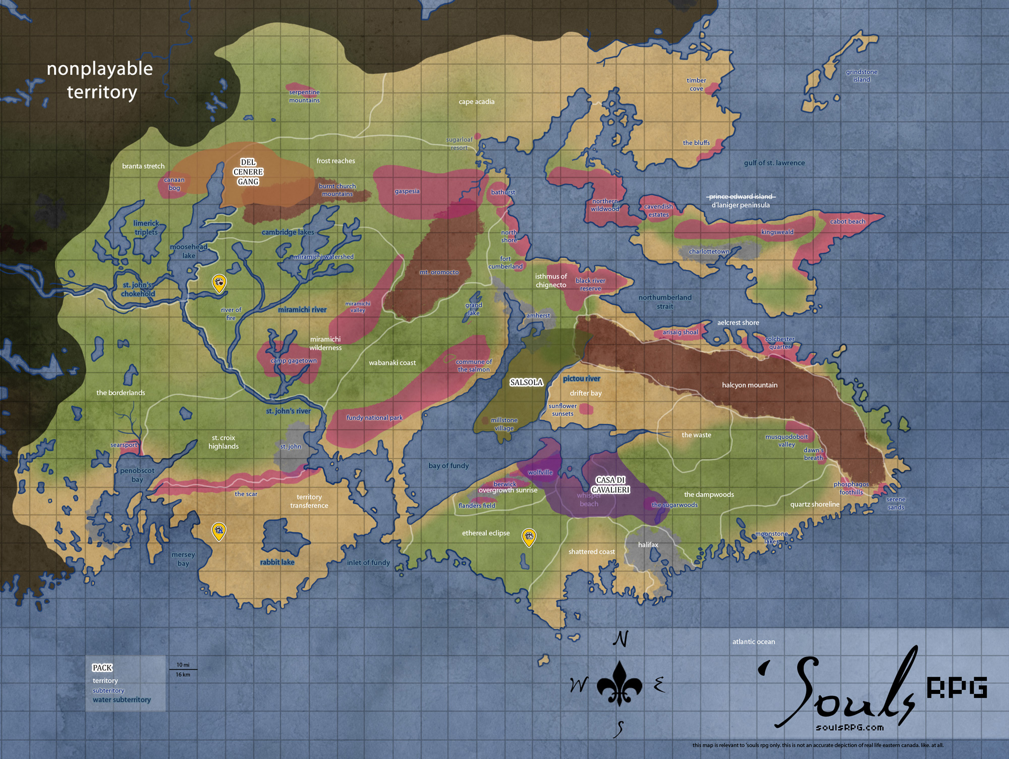
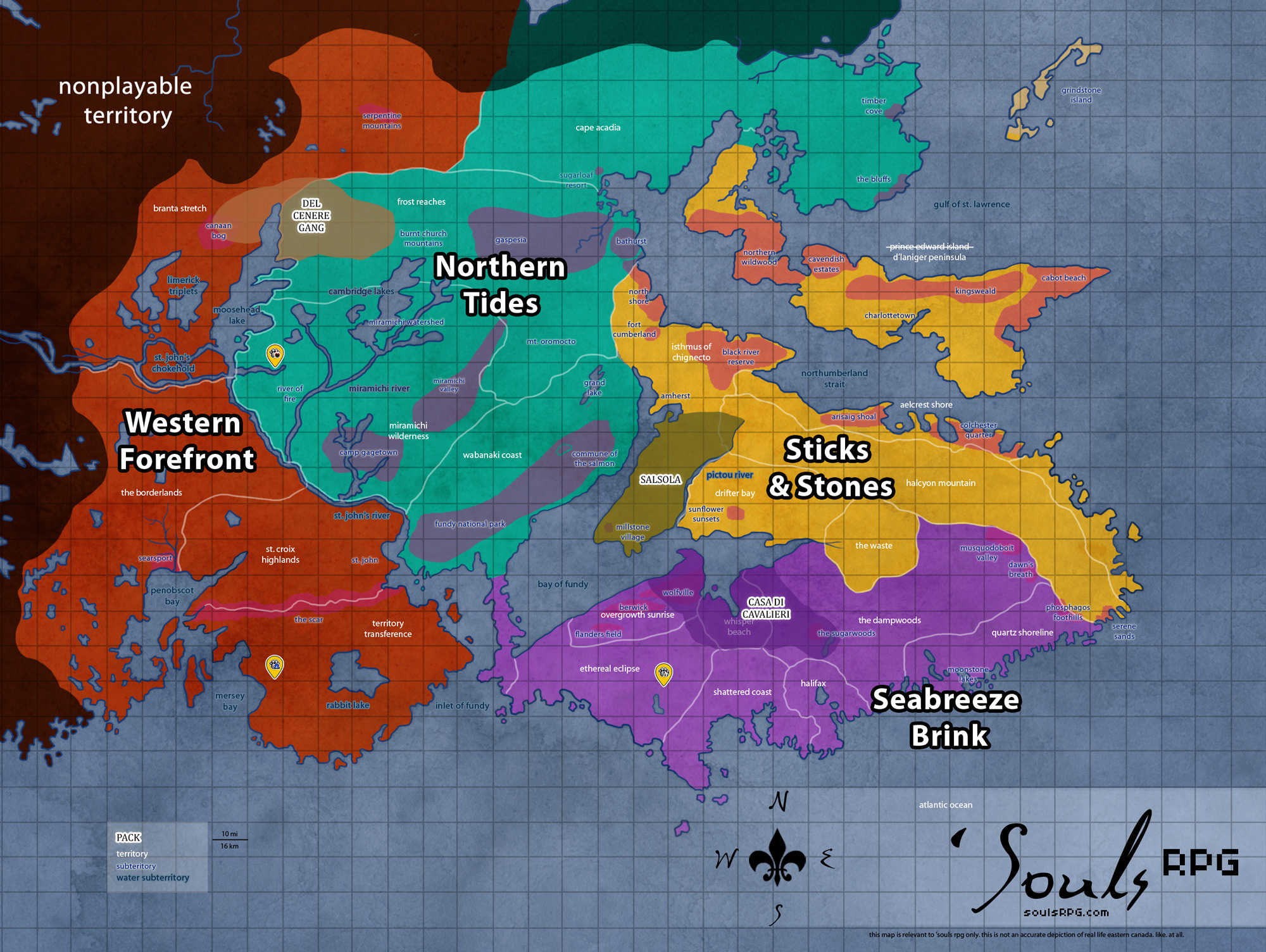
| Region | Sticks and Stones |
| Subterritories | Arisaig Shoal |
| Major Waterways | Northumberland Strait |
| Size | ?? sq km / ?? sq mi |
|
Roleplay! | |
1. Description
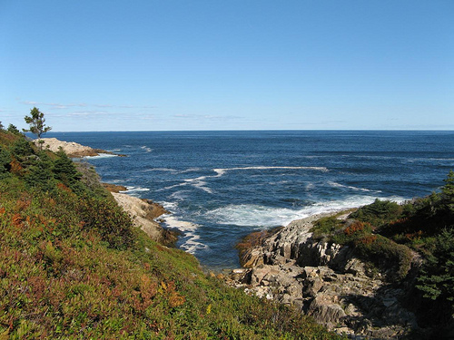
Aelcrest Shore borders the Northumberland Strait, which separates Nova Scotia from Prince Edward Island. Swift, deadly currents and ice-cold waters swept in from the north prevent the use of current boats (and certainly swimming) across to reach the island; however, anyone stumbling across Aelcrest Shore would find it pristine enough. The shoreline isn't quite so harsh as the bay shoreline, nor so foreboding as the Atlantic Shoreline. Grey Seals make their home along this coastline, providing an ample meal for a Luperci devious enough to catch one. In all months but winter, a few species of whale are found in these waters, using them for breeding in summer. Aelcrest was spared the worst of the fires by the presence of the Cobequid Foothills, and they remain intact, though the odd, rare presence of ash in the easternmost areas show evidence of the fire's reach.
2. Subterritories
2.1 Arisaig Shoal
Once Arisaig Provincial Park, this area displays some of the wild evidence of a young earth. At the top of jagged, low-lying cliffs lining shoreline, there lies a flat surface, evidence of a higher sea level. Arisaig also shows some evidence of glaciation -- the inland areas are rolling hills, marked with kettle indentations and drumlin ridges. The occasional erratic boulder has also come to rest in the Arisaig area, dragged to rest in Arisaig park by glaciers long melted. There is an even mix of grasslands and plains here, and from the shore, one can look to north to the vast island, though the swift currents are certain death for anyone attempting a swim.
2.2 Colchester Quarter
Colchester Quarter, deriving its name from the former Colchester County, does not follow the borders of its predecessor; instead, the area consists of a few small coastal and mountain towns, as well as the semi-wild areas in between. A decaying farmhouse can still be found here and there, but it would seem most were abandoned before humanity's demise. The small towns and communities, on the other hand, were still alive and well in 1988; evidence of construction and other human projects, forever halted, still linger in the ghost towns and villages.
3. Waterways
3.1 Northumberland Strait
The shallow Northumberland Strait separates Prince Edward Island from Nova Scotia and New Brunswick. The shallowness of the strait's waters results in very warm summer water -- the Strait has some of the warmest ocean water temperatures on the Atlantic coast north of Virginia. In the winter, however, cold water flowing in from the Gulf of Saint Lawrence cools the water quickly. This is one of the areas within 'Souls playable areas to freeze and display coastal sea ice in winter. Though the channel may freeze entirely, the ice is rarely solid enough to walk across safely.
Central and western coasts of the strait, such as the Isthmus of Chignecto and Aelcrest Shore, as well as the entire south and eastern shore of Prince Edward Island, consist of sandstone. Much of these coasts are beautiful sandy beaches with gentle tides, a stark contrast to the harsh Bay of Fundy coastline to the south. These areas had minimal coastal development in the time of humanity.
4. Islands
4.1 Heron Island
Heron Island is a large island off the north coast of the Aelcrest Shore in the Northumberland Strait. It is quite close to Arisaig Shoal's biggest bay. The island is accessible only at high tide from a wharf on the south side of the island; rocky and foreboding cliffs make approach impossible otherwise. There is a human native traditional burial ground near the northwest end of the island. Large enough to support a thick swathe of tall trees, Heron Island's proximity to land and appearance make it a tempting target for explorative Luperci. The currents in the Northumberland Strait, too, make crossing to Heron Island an easier journey than one of the Fundy islands.
5. History
5.1 Claimed Land
- Ichika no Ho-en claimed the Colchester Quarter region before the pack disbanded.